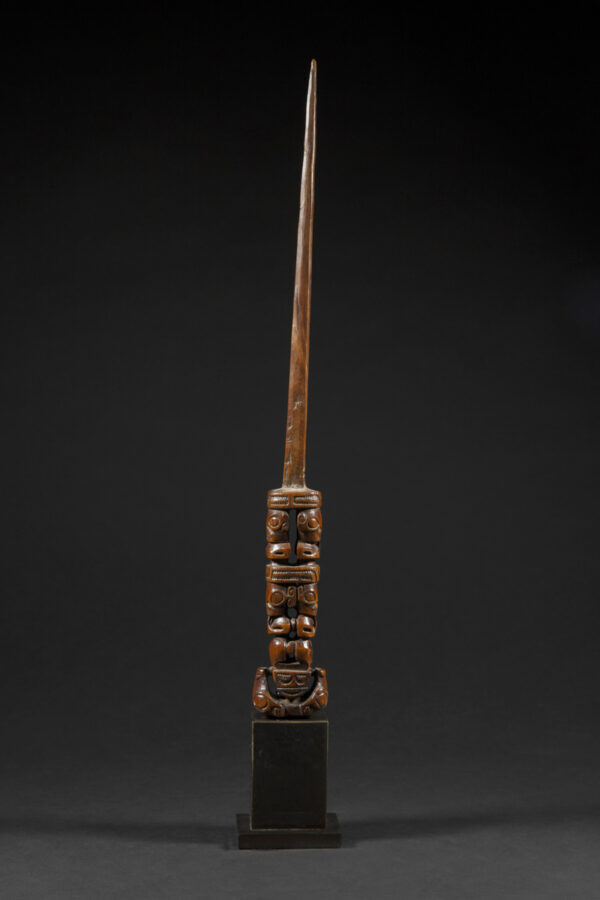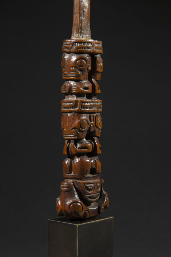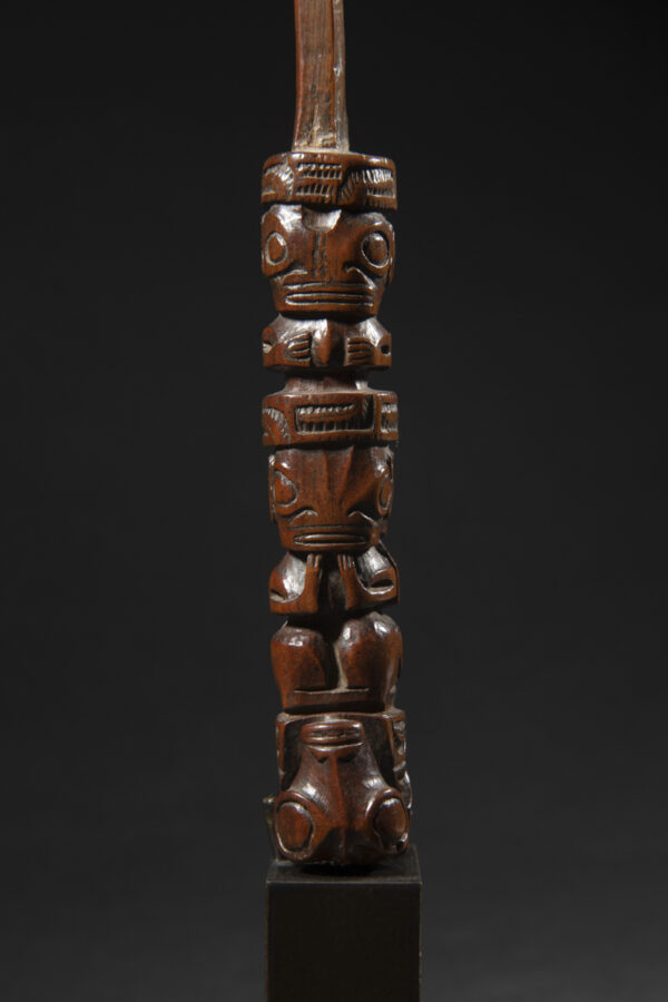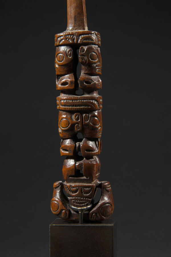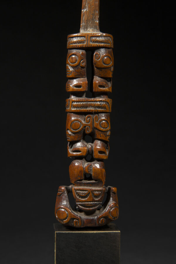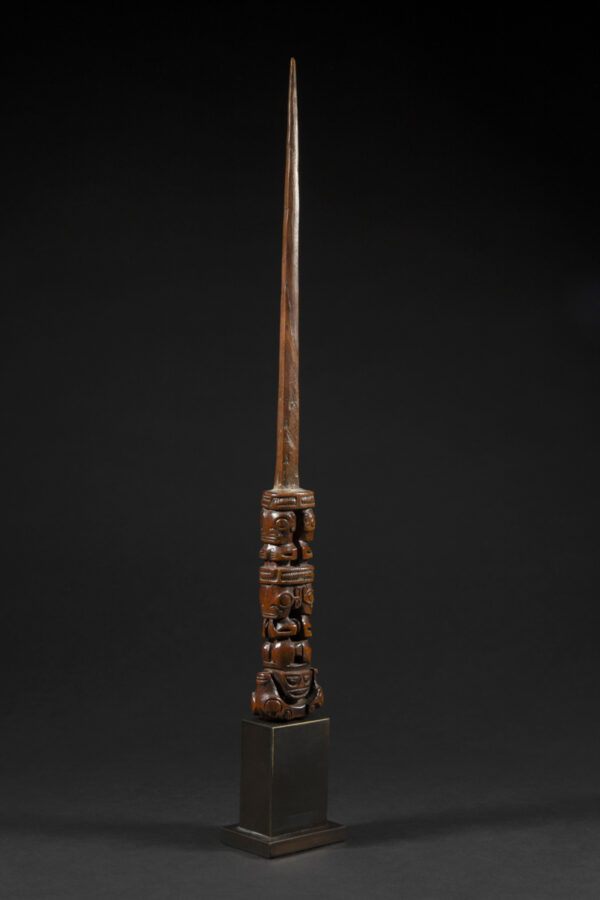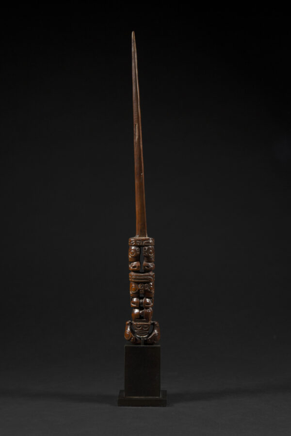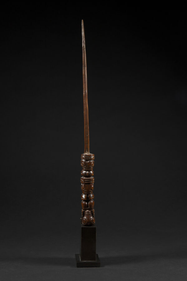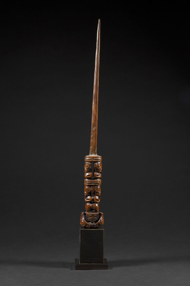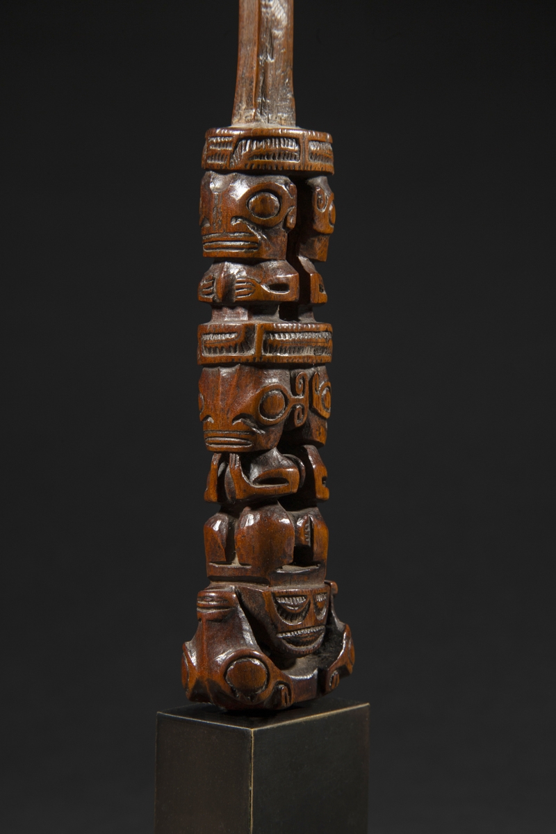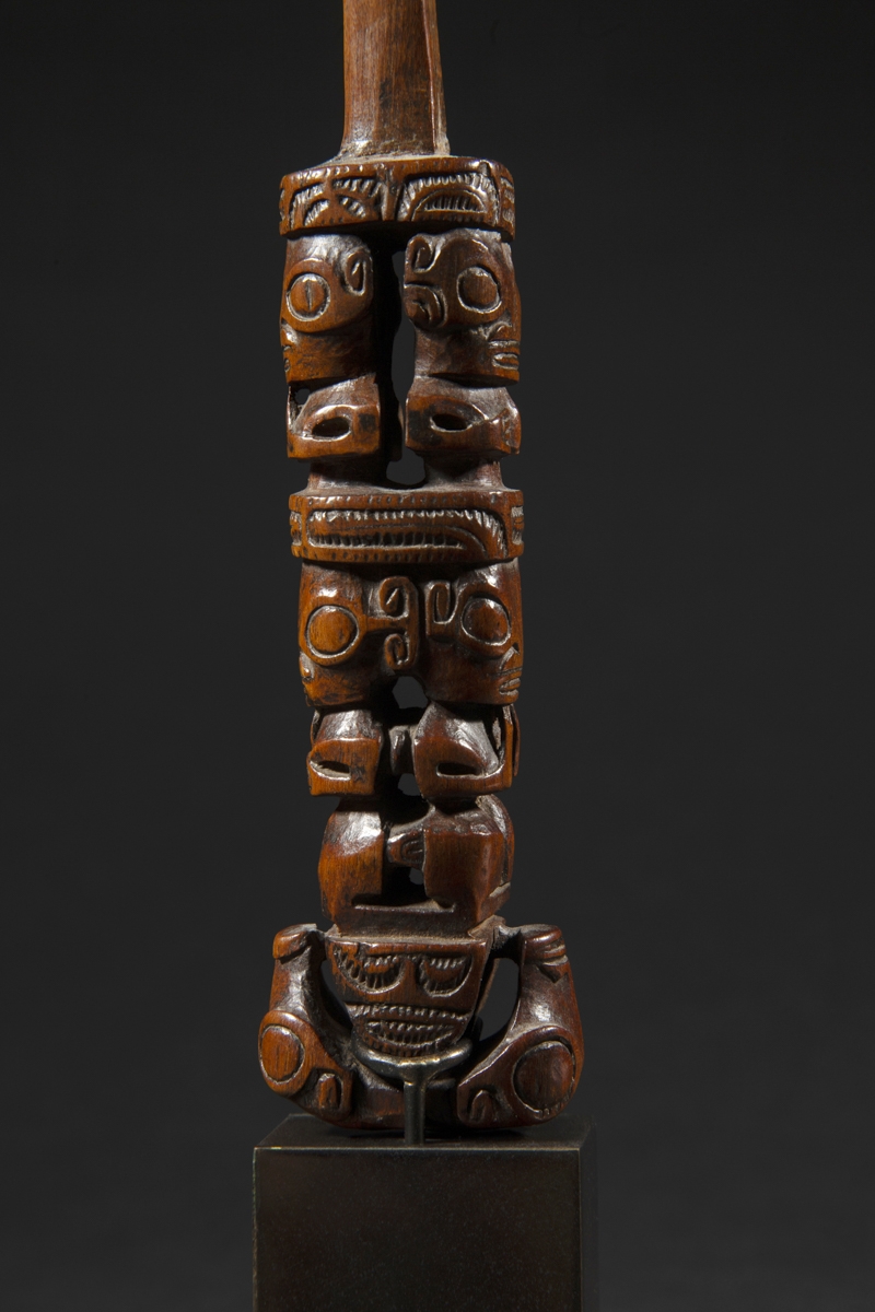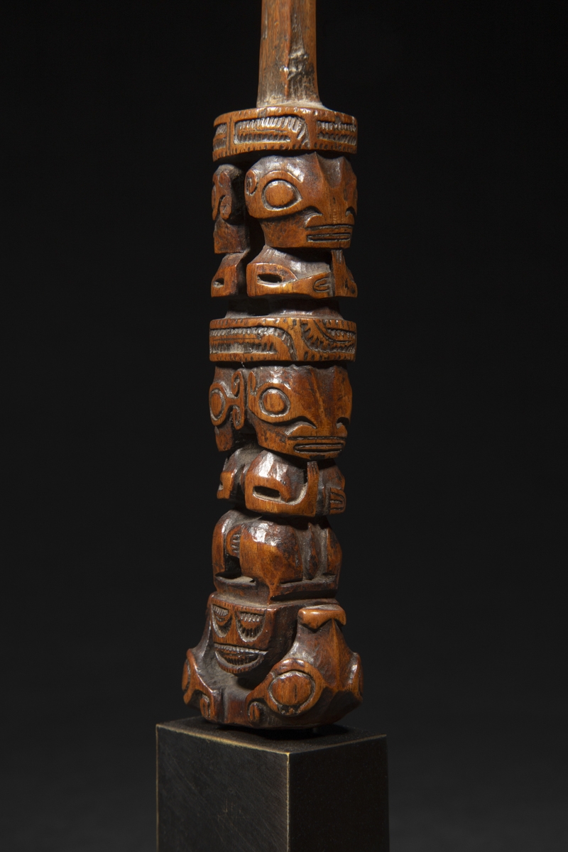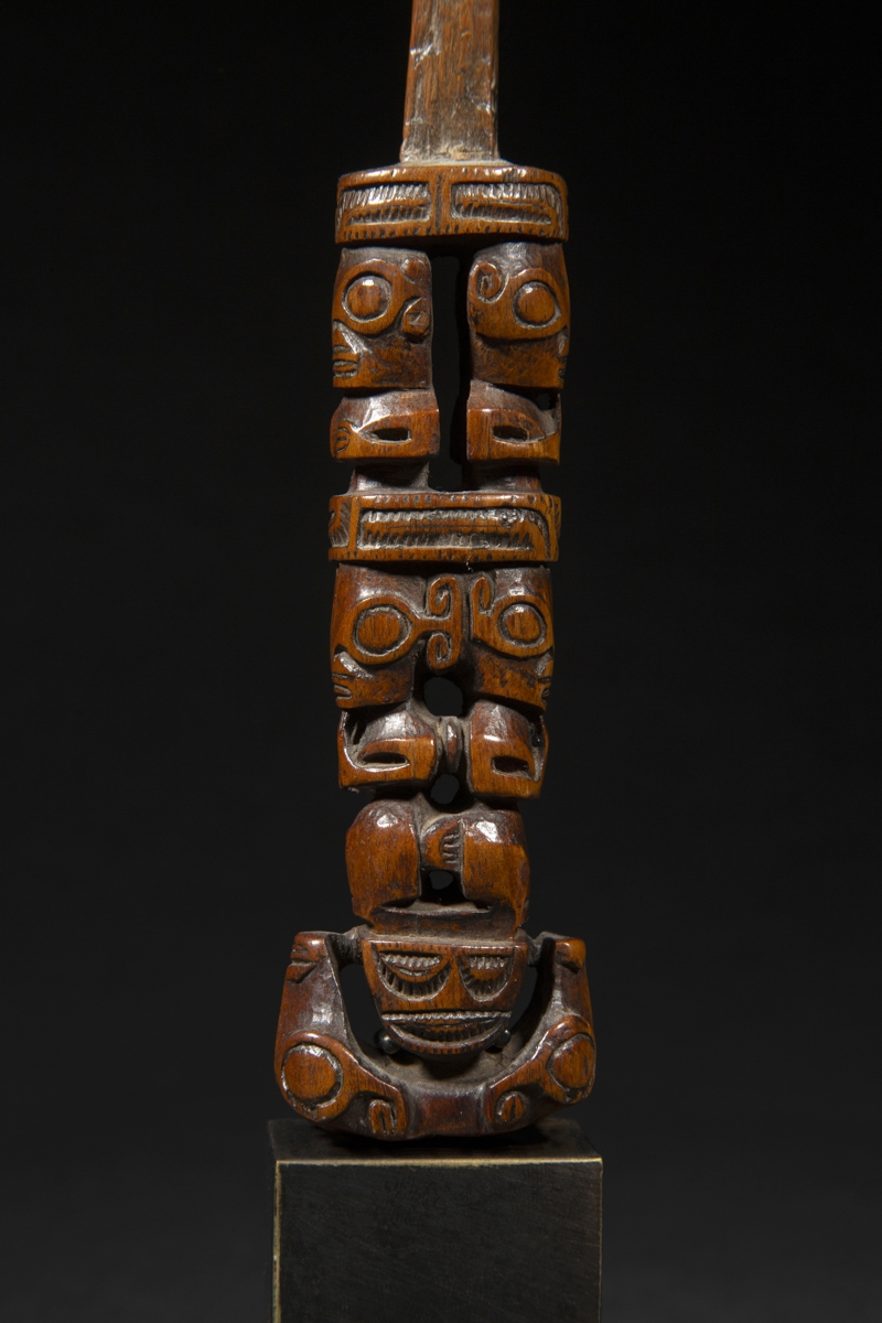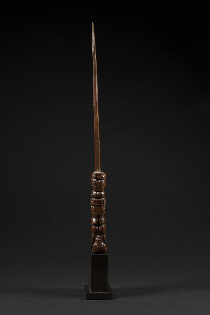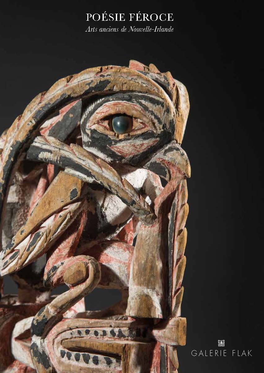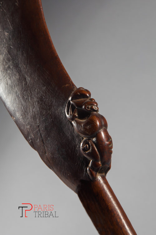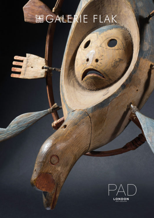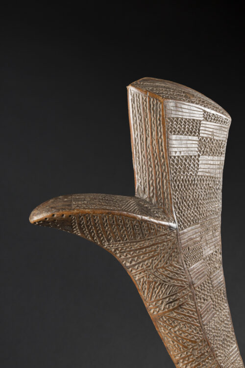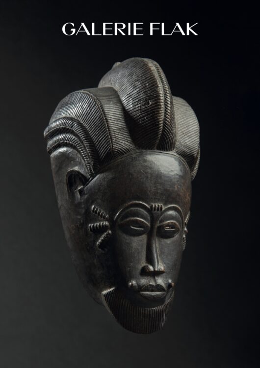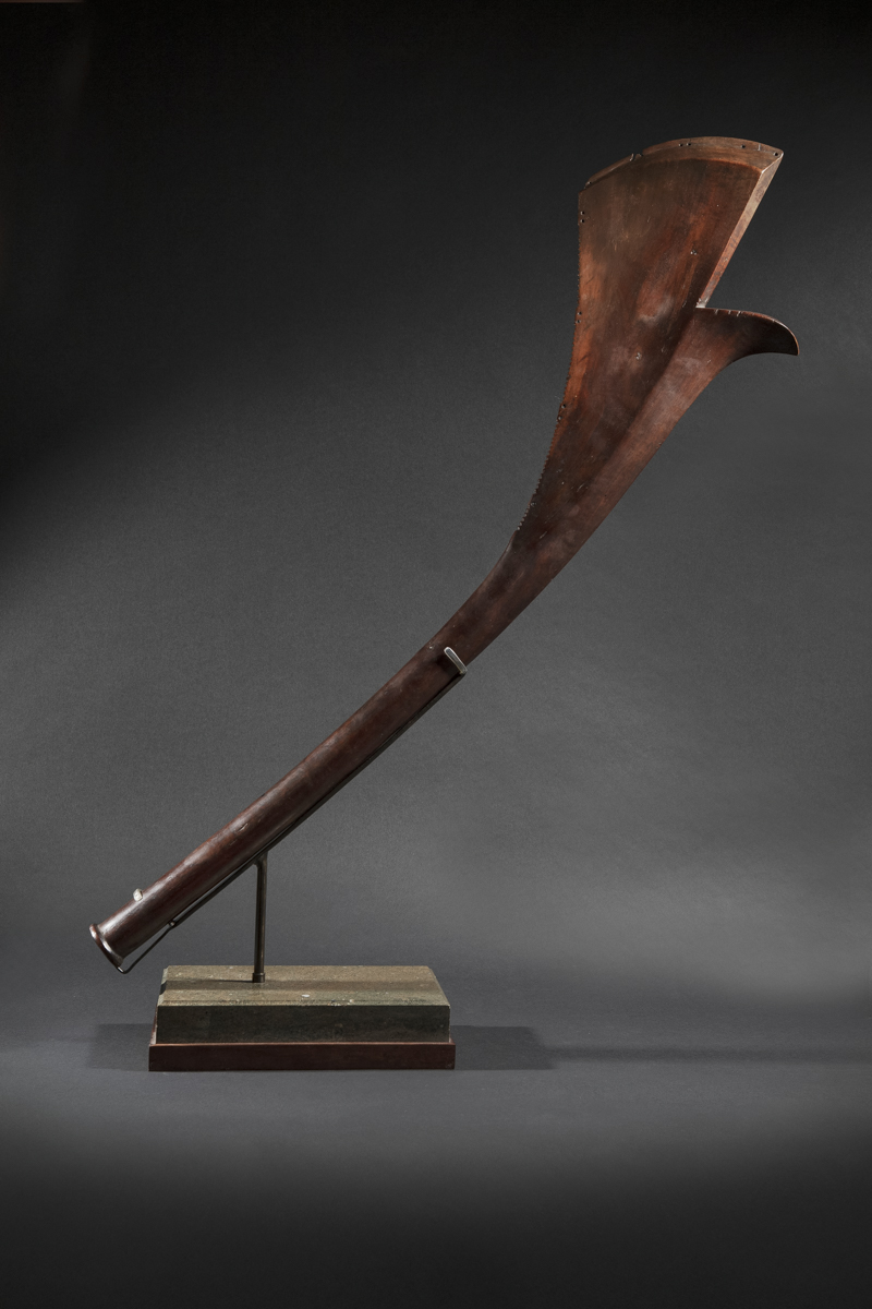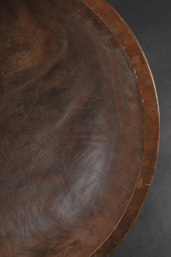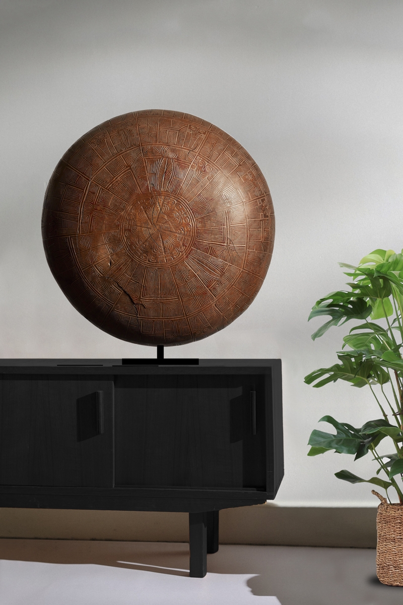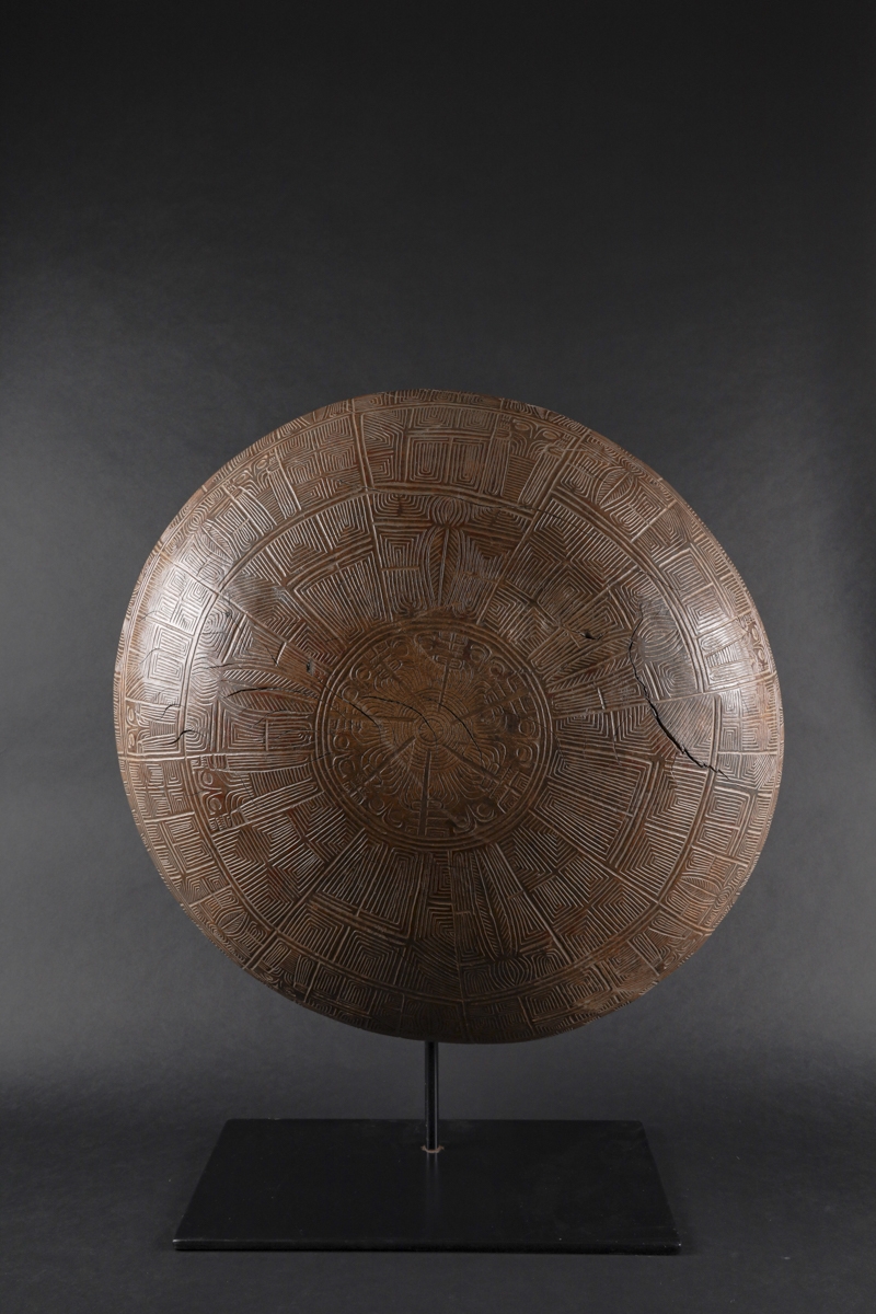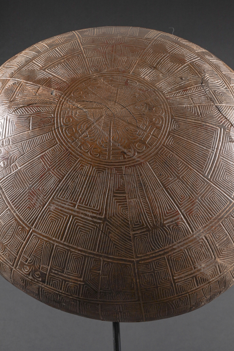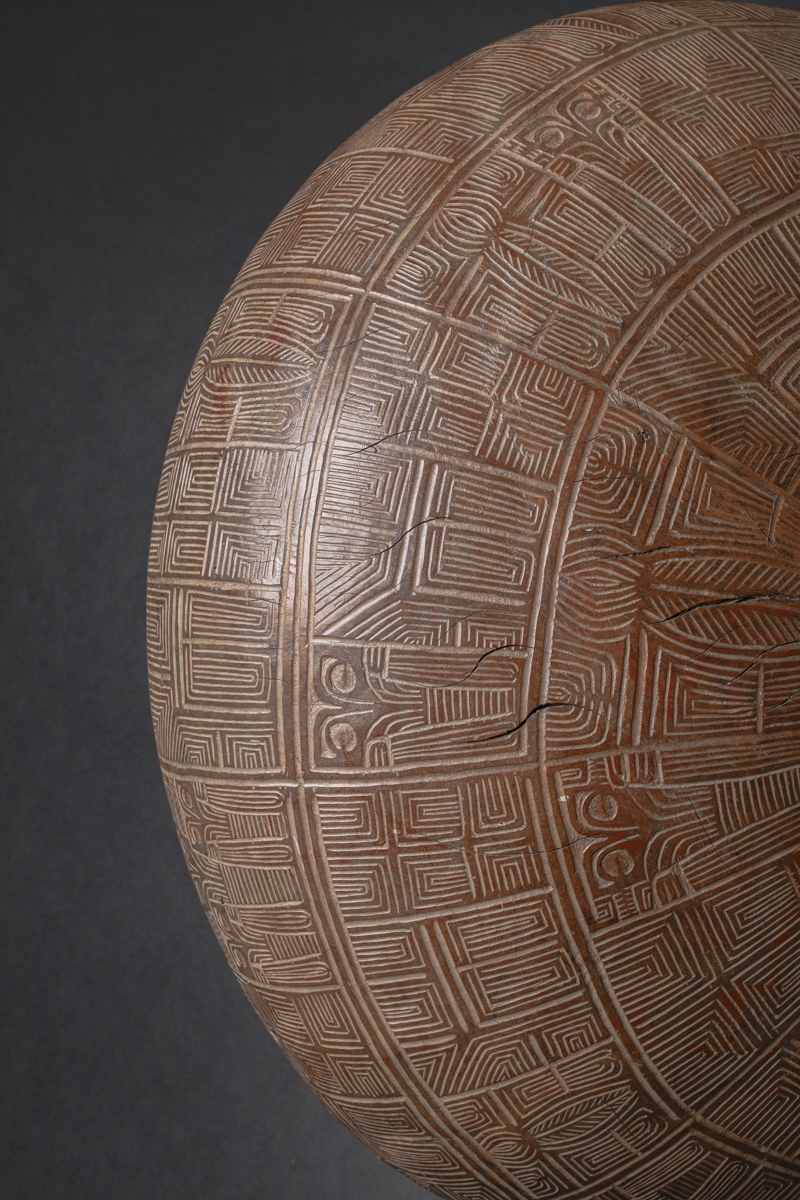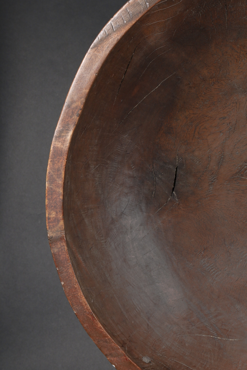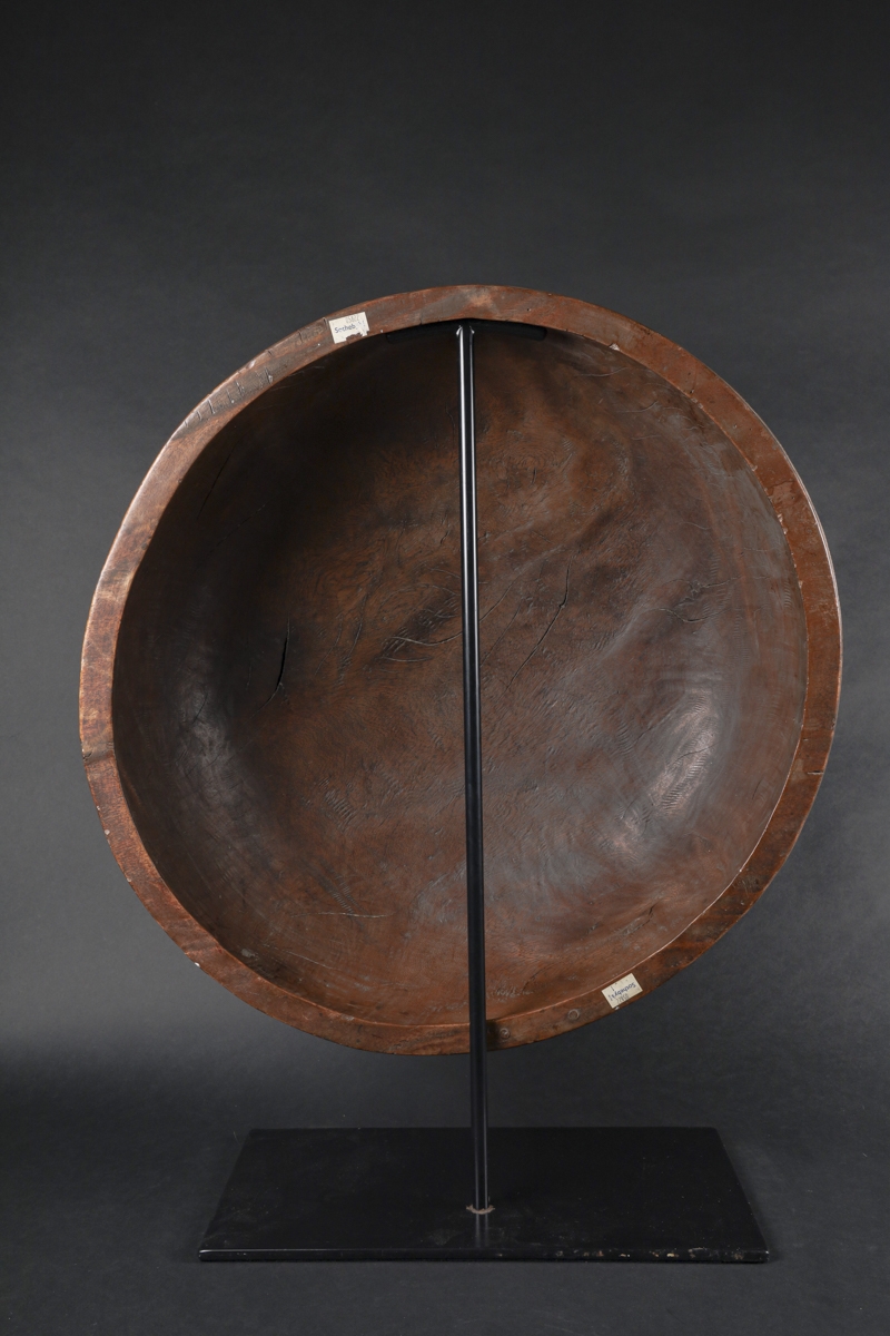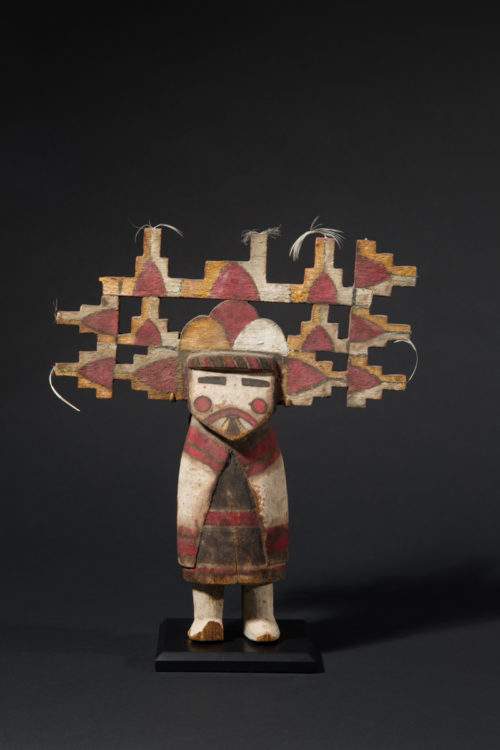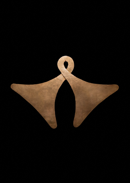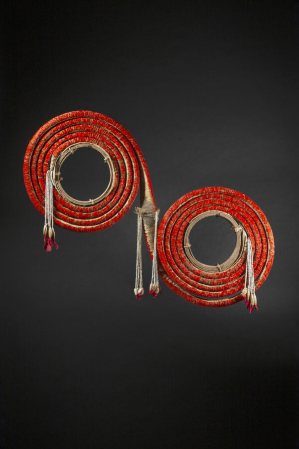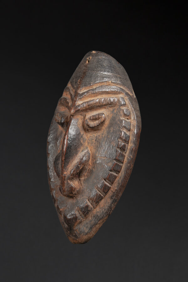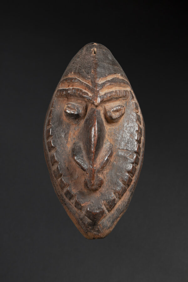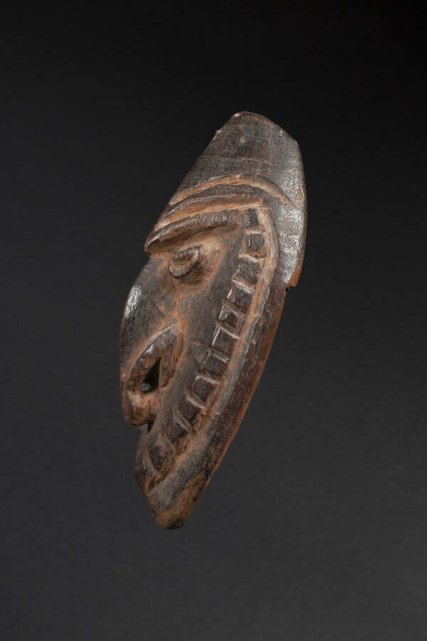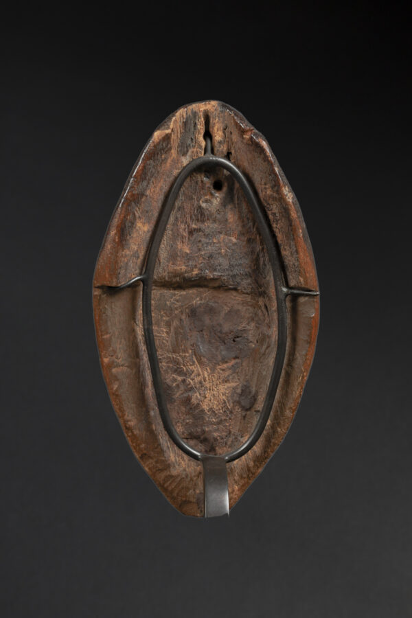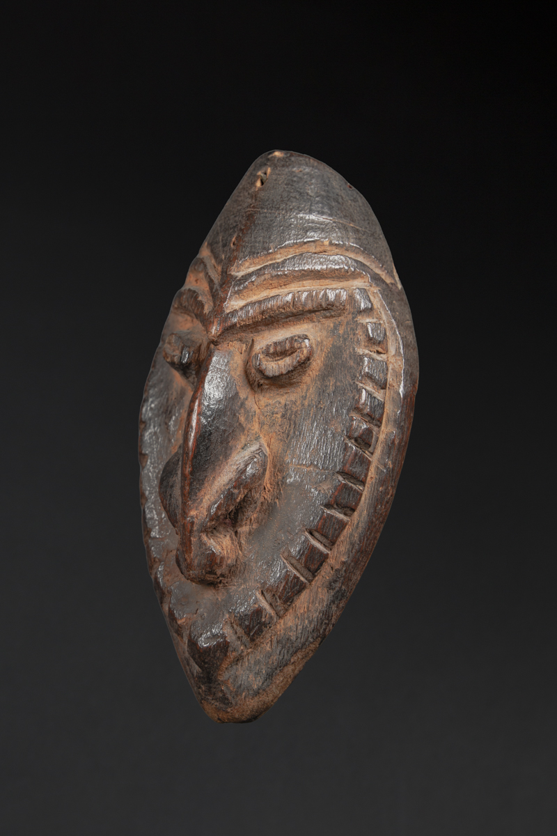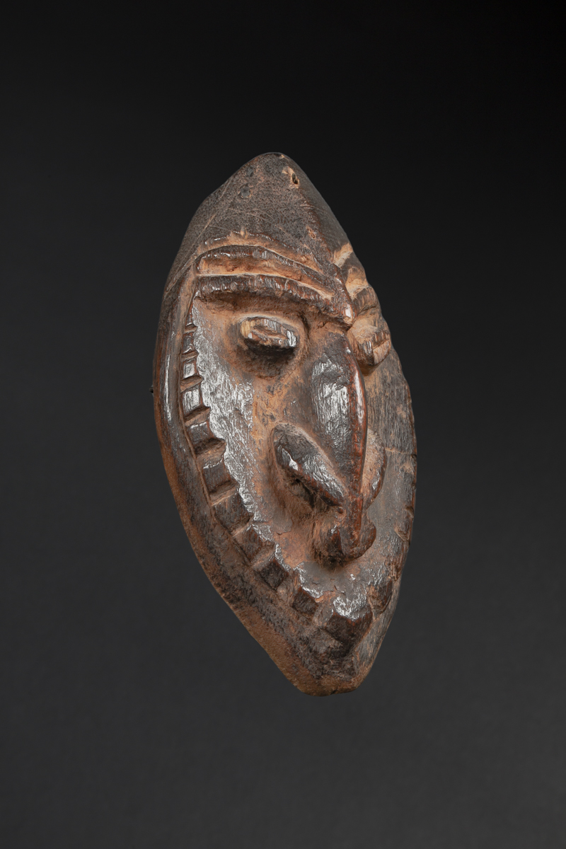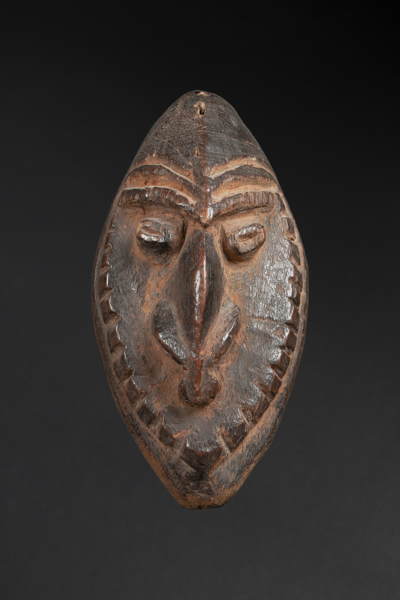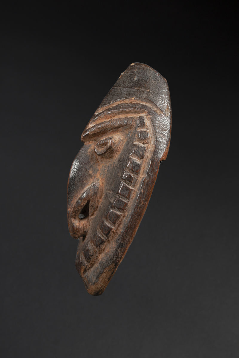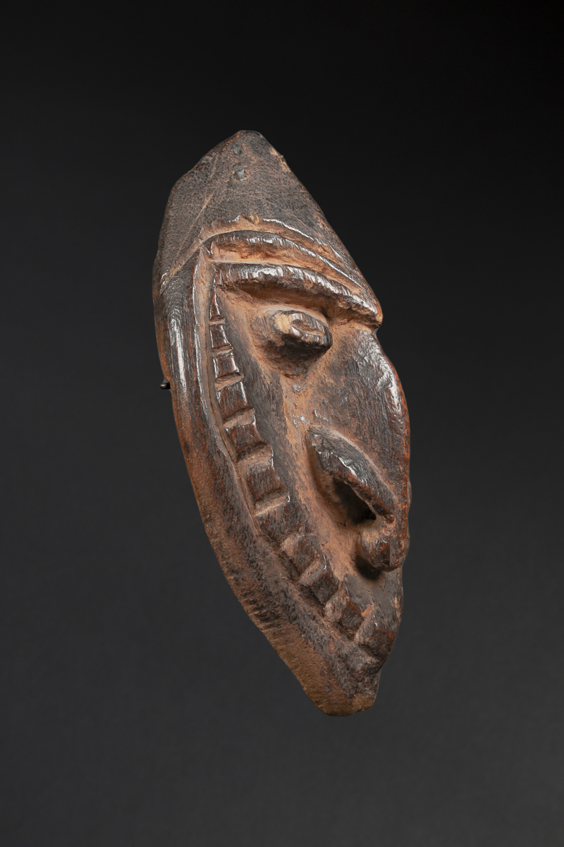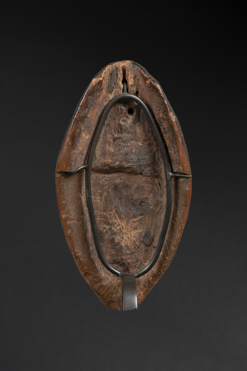
oceania | Marshall Islands
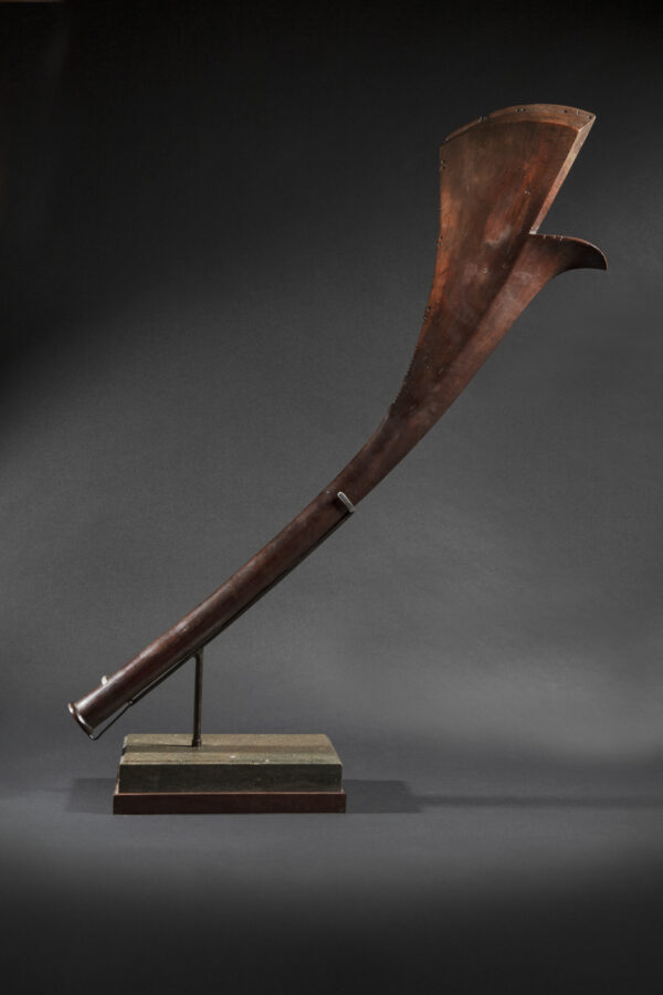
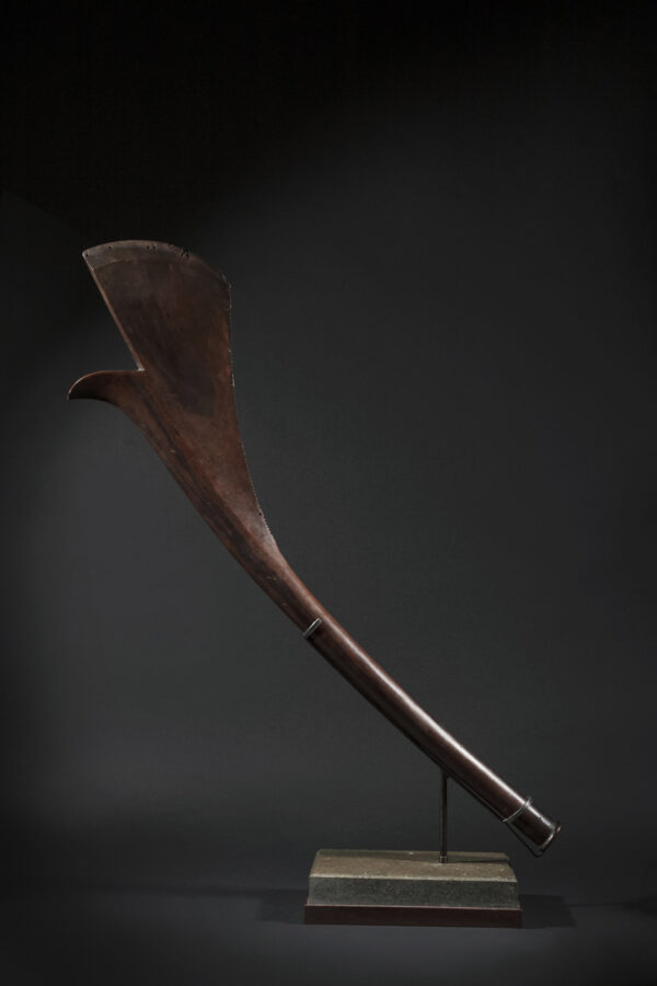
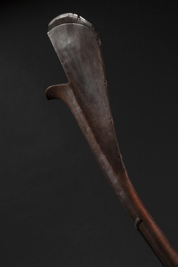
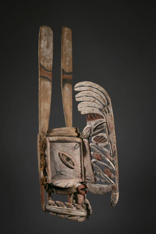
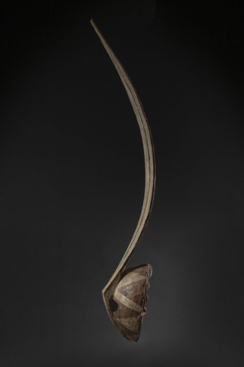
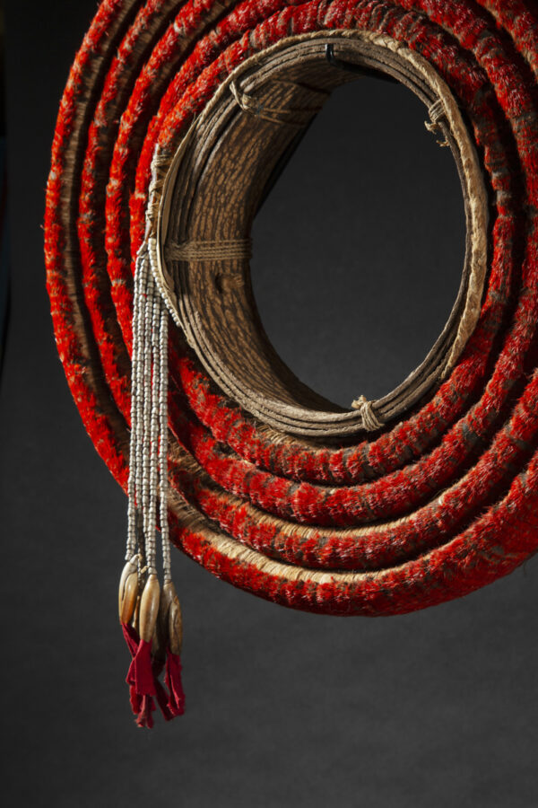
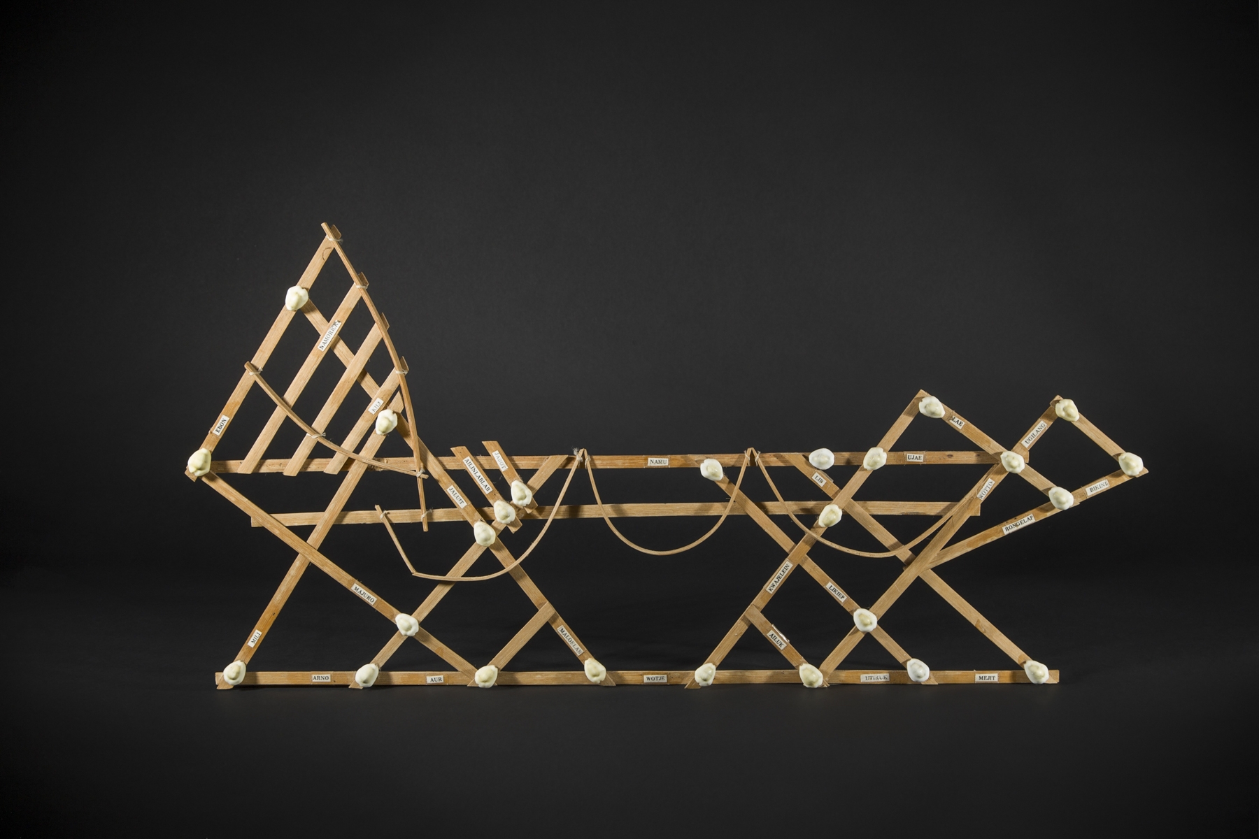
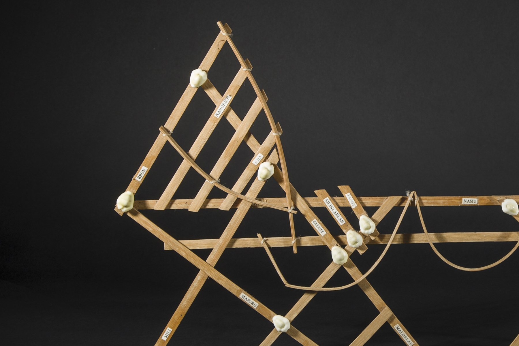
Navigation Chart
Marshall Islands
Navigation chart
Marshall Islands
Micronesia
20th century
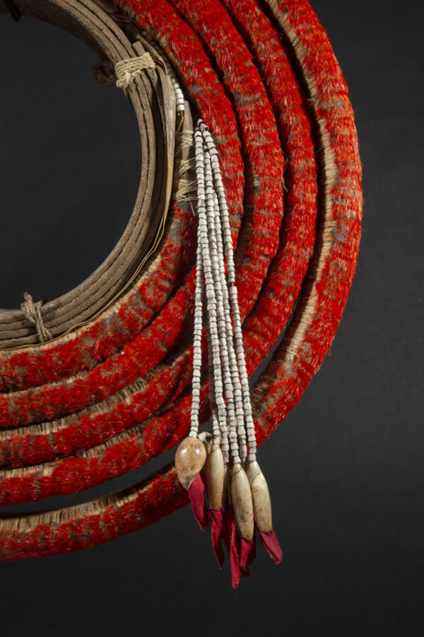
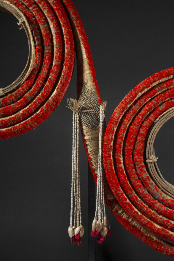
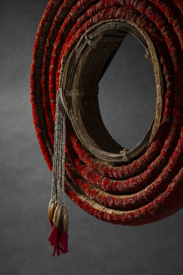
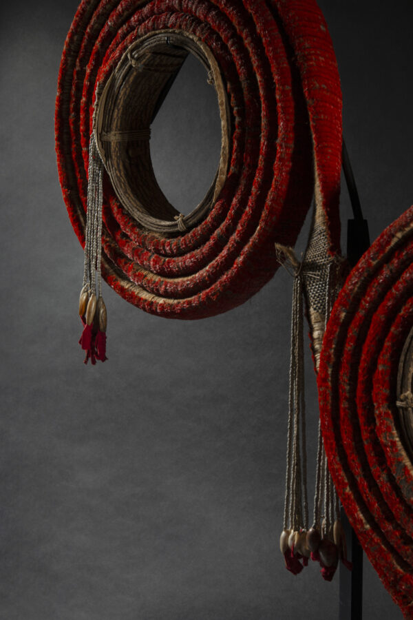
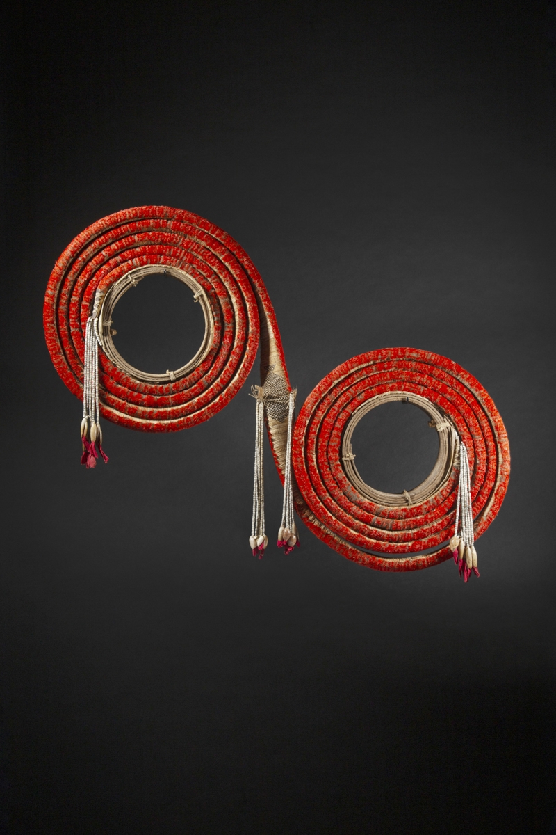
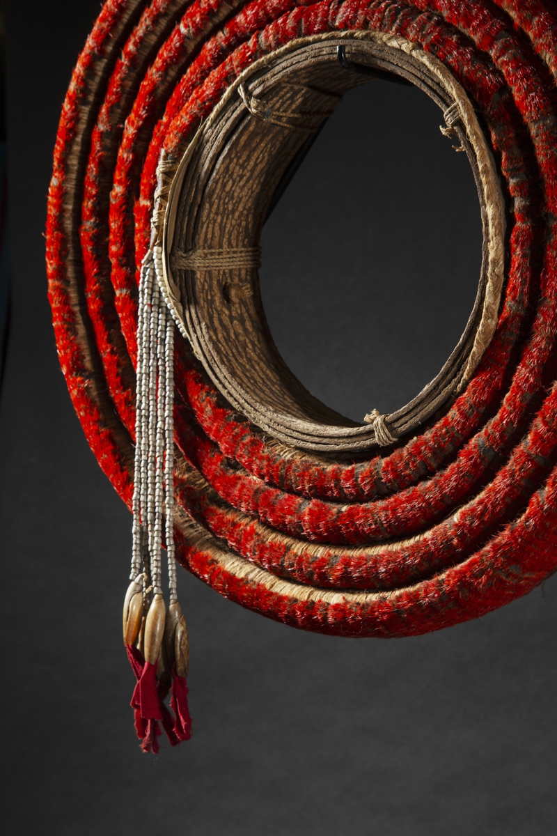
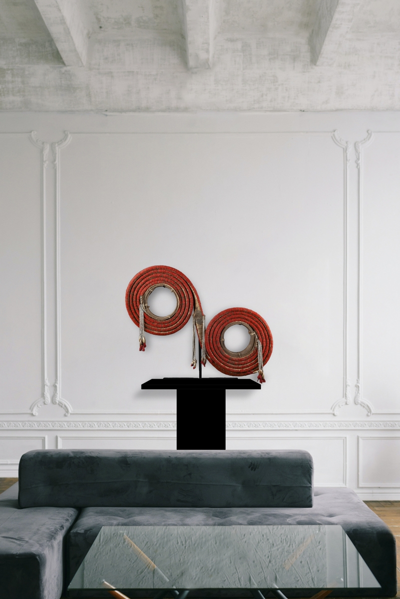
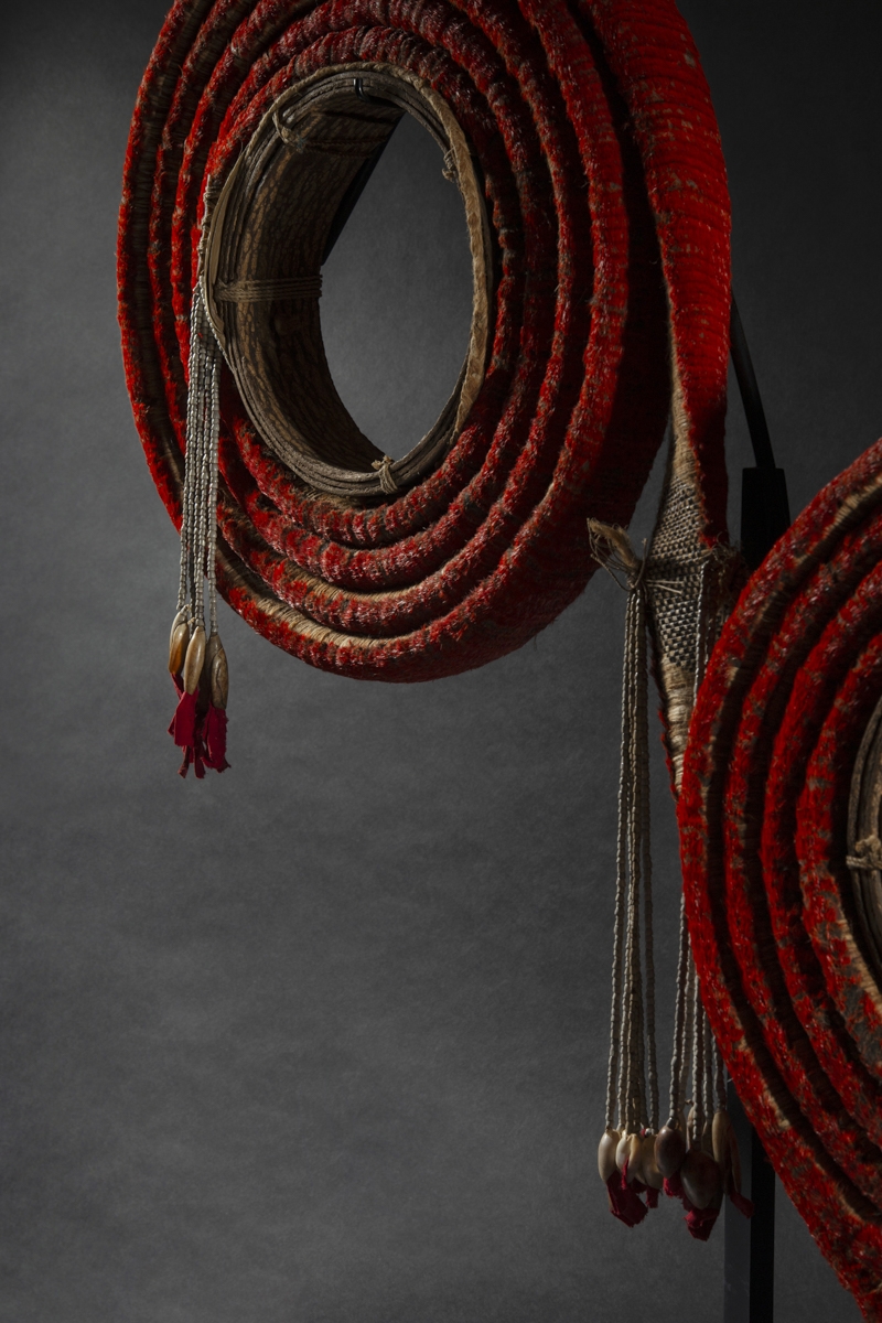
Wood and shells
Length: 56 cm – 22 in.
Provenance
Ex collection J. Kennedy, Hawaii
Ex Bonhams Los Angeles, 2016
Ex private collection, Paris
Marshall Navigation Chart 56 cm / Galerie Flak
Price on request
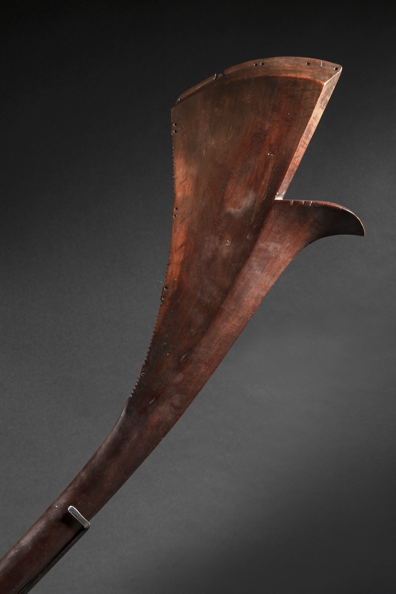
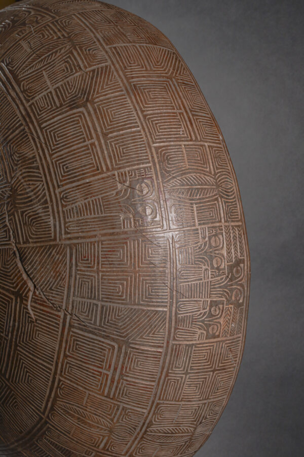
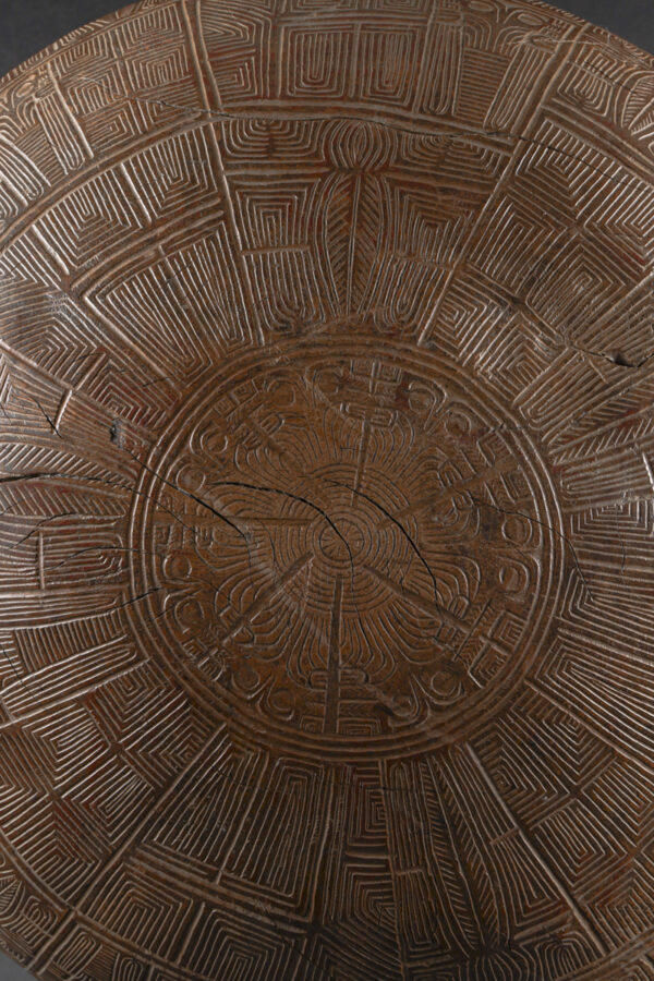
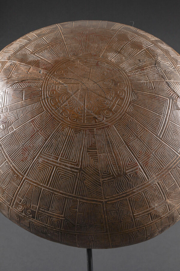
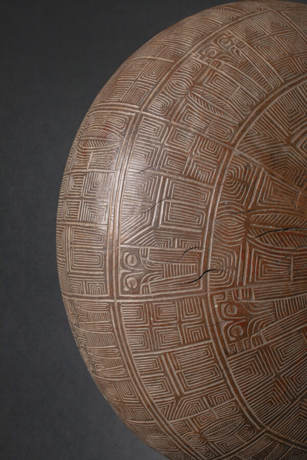
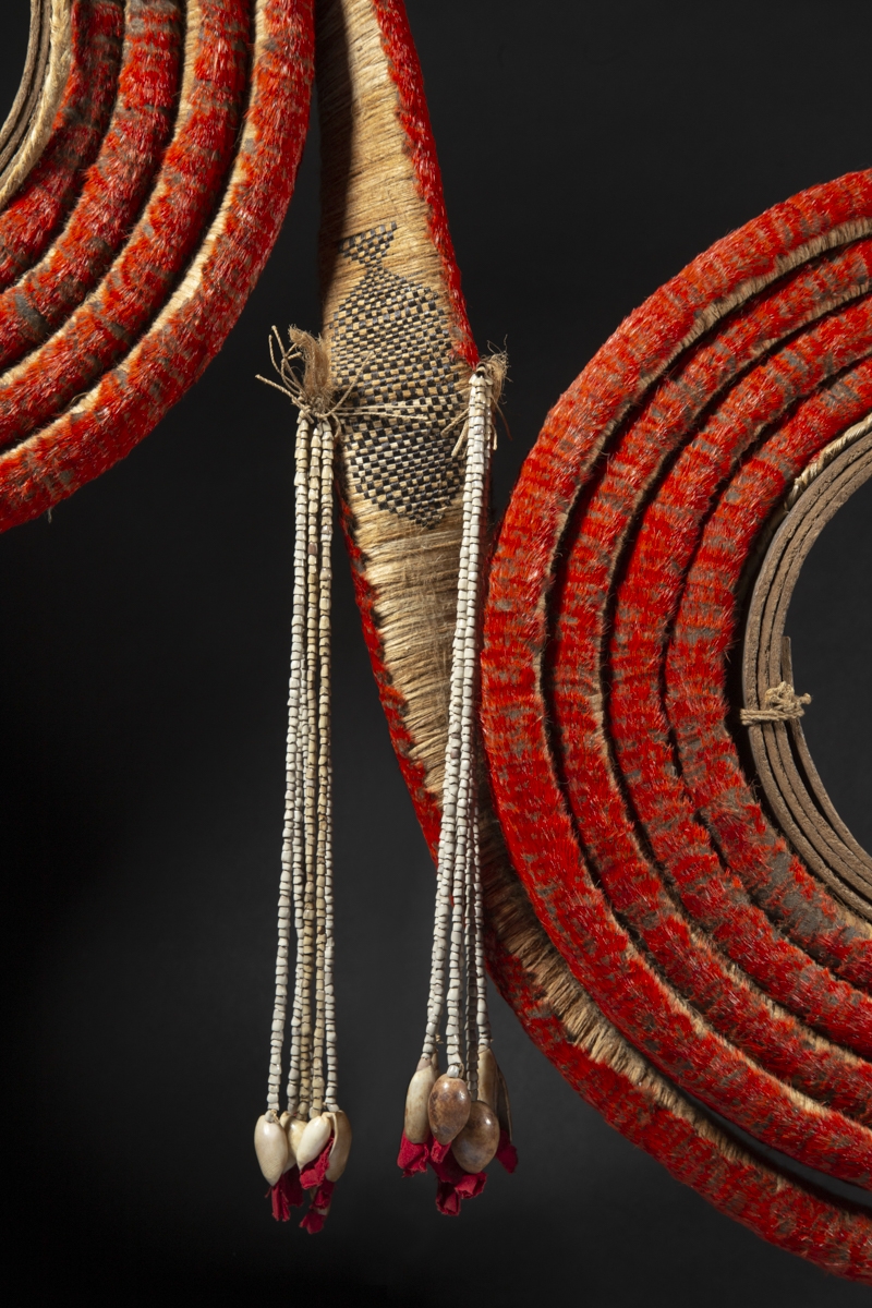
Stick charts were made and used by the Marshallese to navigate the Pacific Ocean by canoe off the coast of the Marshall Islands. The charts represented major ocean swell patterns and the ways the islands disrupted those patterns, typically determined by sensing disruptions in ocean swells by islands during sea navigation. Most stick charts were made from the midribs of coconut fronds that were tied together to form an open framework. Island locations were represented by shells tied to the framework, or by the lashed junction of two or more sticks. The threads represented prevailing ocean surface wave-crests and directions they took as they approached islands and met other similar wave-crests formed by the ebb and flow of breakers. Individual charts varied so much in form and interpretation that the individual navigator who made the chart was the only person who could fully interpret and use it. The use of stick charts ended after World War II when new electronic technologies made navigation more accessible and travel among islands by canoe lessened. The stick charts are a significant contribution to the history of cartography because they represent a system of mapping ocean swells, which was never before accomplished. They also use different materials from those common in other parts of the world. They are an indication that ancient maps may have looked very different, and encoded different features from the earth, than the maps we use today.
The charts, unlike traditional maps, were studied and memorized prior to a voyage and were not consulted during a trip, as compared to traditional navigation techniques where consultation of a map is frequent and points and courses are plotted out both before and during navigation.
Marshallese navigators used their senses and memory to guide them on voyages by crouching down or lying prone in the canoe to feel how the canoe was being pitched and rolled by underlying swells.
"Fearless and adventurous voyagers as the Polynesians were in former centuries, they appear never to have studied ocean phenomena in their bearing on the science of navigation with anything like the painstaking and methodical skill which the Marshall Islanders devoted to this subject. Doubtless by observation their sailing experts could infer much from the run of the ocean swells, but this knowledge was comparatively elementary and was never detailed, tabulated, and set forth in the form of primitive charts. In the Marshall Islands, on the contrary, every chief and sea pilot possessed elaborate charts based upon his own experience and on knowledge handed down or gained from others." (Canoes Of Oceania, Haddon & Hornell, 1975: p. 372)
Explore the entire collection